Tehachapi Loop
Tehachapi Loop: Southern Pacific's Way Into the Desert
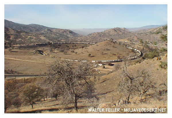
The Tehachapi Loop was Southern Pacific's answer to a problem that could not be solved by simply laying track uphill. To reach Mojave and the western edge of the Mojave Desert, the railroad had to cross the Tehachapi Mountains, the short but steep range separating the San Joaquin Valley from the desert country beyond. A railroad could tolerate only a limited grade. Beyond that point, locomotives lost their ability to pull loaded trains safely and economically.The solution was not a straight route over the pass, but a carefully engineered detour. Southern Pacific built a line that curved around the mountainside, entered a tunnel, and turned in a full circle around a central hill. In the process, the track crossed over itself. It was a strange-looking solution, but it gave the railroad the distance needed to climb.
A railroad problem in the mountains
The railroad reached Bakersfield in 1874. From there it still faced the climb through Tehachapi Pass and the descent toward Mojave. The challenge wasn't merely to get rails through the mountains. The line had to be built to standards that freight trains and steam locomotives could live with every day.A wagon road could take the shortest route and accept steep pitches, mud, washouts, and hard turns. A railroad could not. Its locomotives needed fuel and water; its heavy freight cars needed controlled grades; and the track itself had to be stable enough to carry constant traffic. Every mile of extra distance cost money to build, but an excessive grade could make the entire route impractical.
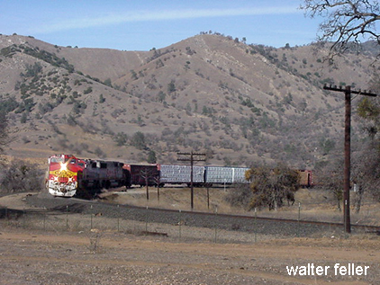
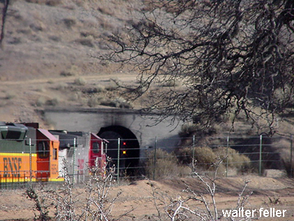
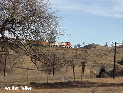
Southern Pacific civil engineer William Hood devised the key feature of the crossing: the Tehachapi Loop. The loop itself is about 3,799 feet long. By making a complete circle around the hill and passing through Tunnel 9 below the upper track, it gained about 77 feet of elevation while keeping the grade at about 2.2 percent. A train long enough to fill the loop can pass over its own rear cars.
The Loop was not an amusement or a visual flourish. It was a working piece of railroad geometry. Hood used distance to trade for elevation. Rather than force a train to make one steep climb, the line spread the climb over a longer route.
Building the line
The Loop was only one part of a much larger mountain railroad project. The Tehachapi Pass line required extensive grading, tunnels, bridges, cuts through granite, drainage work, and water facilities for steam locomotives. Construction crews had to create a route where there had been no railroad route before.Much of that labor was performed by Chinese railroad workers. As many as 3,000 Chinese laborers are associated with the Tehachapi construction. They worked with picks, shovels, black powder, horse-drawn carts, and hand tools to cut roadbed through solid and decomposed granite. The engineering achievement depended on their labor, endurance, and skill as much as it did on the plans made in company offices.
J. B. Harris directed construction, while Hood and other Southern Pacific engineers worked out the alignment and grades. The work proceeded rapidly. Built between 1874 and 1876, the Tehachapi route became the final link in the first direct railroad connection between San Francisco and Los Angeles.
The mountain gateway
The railroad crossed Tehachapi Pass about 14 miles northwest of the town of Tehachapi. From the San Joaquin Valley side, it climbed toward the pass; on the far side, it descended toward Mojave. The line became a 70-mile mountain crossing between Bakersfield and Mojave, with the Loop as its most famous feature.Before the railroad, the pass was a difficult overland barrier. Roads and trails crossed the Tehachapis, but transportation remained slow, seasonal, and expensive. The new railroad made the crossing dependable enough for regular freight, mail, passengers, machinery, and supplies. It tied Southern California more closely to the San Joaquin Valley and San Francisco, while giving Mojave a permanent connection to the state's larger rail system.
For the Mojave Desert, that connection mattered. Mojave became a rail point at the edge of the desert rather than an isolated stopping place on a wagon road. In later years it developed into an important junction for lines serving the Owens Valley, mining districts, and the desert interior. The Tehachapi route did not create every later desert railroad, but it established the western gateway through which much of that later traffic would move.
A route built to last
The line endured because its basic engineering was sound. The Tehachapi Loop has required maintenance, improvements, and repairs over the years, including work after the 1952 Kern County earthquake, yet the original solution remains in service. Southern Pacific became part of Union Pacific in 1996, yet the Loop still carries freight trains over the same mountain barrier.It is often called one of the great railroad engineering works of the West. That reputation comes not only from the sight of a train passing over itself, but from what the Loop represents. Southern Pacific had reached the point where the mountains would not allow an easy route into the desert. The company could either stop, accept an impractical grade, or build something unusual.
It built the Loop.
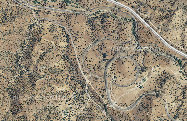
Satellite image of Tehachapi Loop
Southern Pacific Railroad
San Bernardino, Ca.
Southern Pacific Railway Company